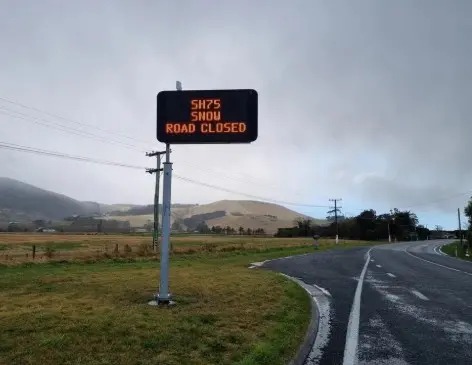
Canterbury's brief taste of summer is set to be followed by a reminder that October still has a winter edge, with MetService warning of a front that will drag colder, wetter air up the South Island.
Eastern parts of Canterbury were forecast to feel unusually warm on Tuesday as strengthening northwesterlies pushed temperatures well above average for the time of year. Some areas were expected to approach 27C before the change arrived.
The front is expected to move north from the southern South Island on Wednesday, bringing rain, a southerly shift and a noticeable temperature drop. MetService meteorologist Maddy Neal said residents may want to keep winter bedding close, because warmer weather is being replaced by a wet winter chill.
For Christchurch, the practical effect is a fast swing in what people need to plan for. A warm afternoon can turn into a colder commute, and gardeners, contractors, event organisers and rural households will all be watching how much rain arrives with the change.
The high country is the bigger caution point. A dusting of snow is possible on higher South Island passes and farms, while heavy rain watches have been issued for parts of the western ranges. Even if Christchurch itself avoids the worst of the weather, the city is still tied to those routes through freight, tourism and weekend travel.
The timing also matters because parts of the country have started October drier than normal. Rain can be welcome for dry soils, but a sharp front does not behave like a gentle refill. It can bring sudden road, farm and event complications even when the broader moisture picture needs improvement.
This is the kind of weather story Canterbury knows well: warm northwesterlies, a quick change, and a South Island reminder that spring is not a straight line. The advice is not dramatic, but it is useful. Check the forecast before heading over the passes, plan for colder conditions after the change, and do not treat Tuesday's warmth as a guide to the rest of the week.